Plainfield Thoroughfare Plan
Plainfield, IN
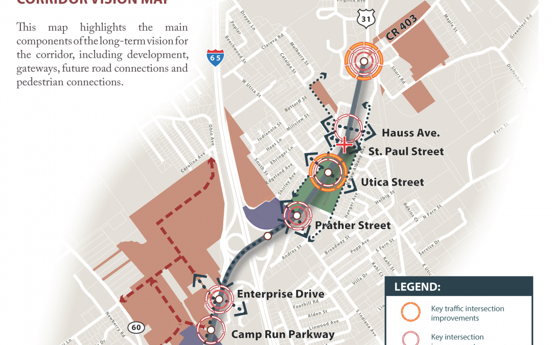
Thoroughfare Plan
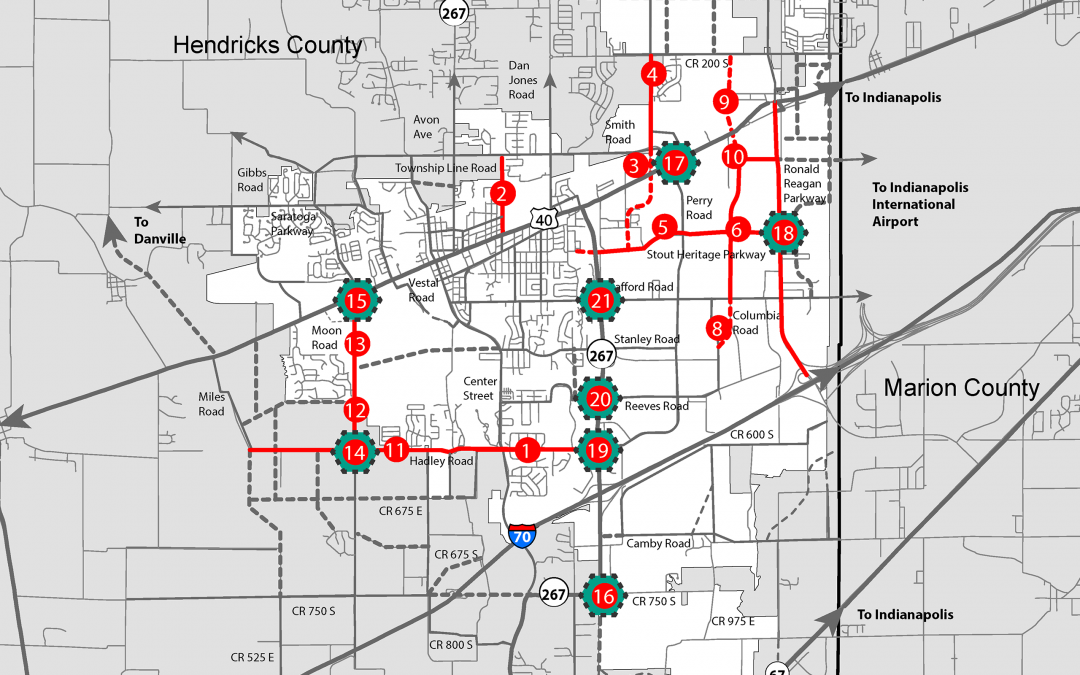
As a result of rapid growth in the community and the resulting demands on its transportation network, there was a need to update Plainfield’s thoroughfare plan. HWC led detailed traffic modeling of all roadways in Plainfield and evaluated multiple development scenarios to identify transportation improvements that provided the greatest return on investment. The plan also evaluated the feasibility of a future Interstate 70 interchange west of SR 267.
Recent Comments